

33 CARATS
33 Carats gold project
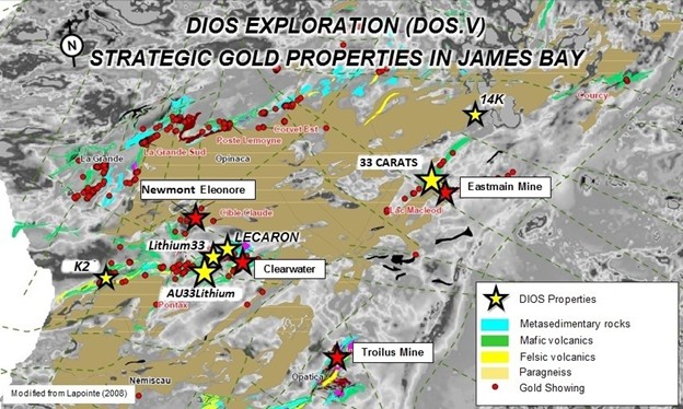
In Upper Eastmain Greenstone belt, James Bay/Eeyou-Istchee, 33 CARATS gold property is located 6 km northwest of Eastmain Mine gold deposit (Benz Mining) reported containing NI 43-101 and JORC (2012) compliant resource of 376,000oz at 7.9 gpt gold (Indicated: 236,500oz at 8.2g/t gold, Inferred: 139,300oz at 7.5g/t gold).
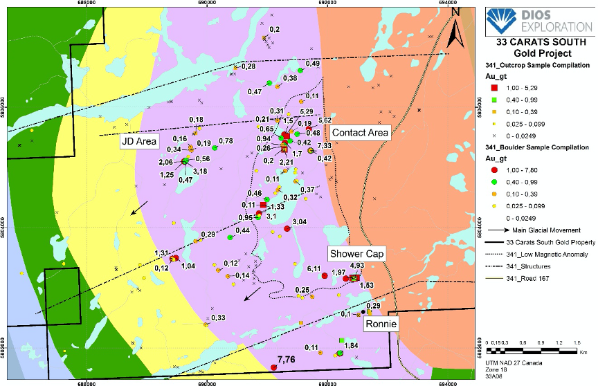
Property is accessible all year through road 167 to Renard diamond deposit and 33 Carats (64 claims for 3369.3 hectares (33.69 km2).
Strong potential of 33 Carats gold project, northwest of adjacent Eastmain gold mine property, in NW strike with structural/stratigraphic Eastmain Mine Trend hosting most of significant gold & copper showings in the area
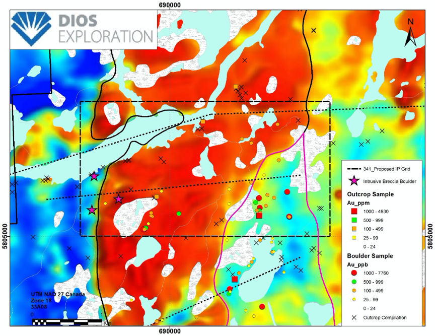
Previous Dios work consisting of prospecting, geological mapping and soil sampling delineated a highly prospective area within felsic (tonalite) intrusion, up-ice of significant gold-in-till dispersal train.
Property contains favourable sequence of felsic volcanics in contact with magnetic tonalite. Bohier tonalite hosts numerous porphyry-type Au-Ag-Cu (up to 7.76 g/t Au, 17.8 g/t Ag, 4.64% Cu) occurrences within magnetic low.
Typical mineralization consists of disseminated /stringer pyrite-chalcopyrite associated with 1-5% biotite-magnetite and/or quartz stringers /veinlets.