

AU33
The gold areas can be followed laterally and deeply.
Hole 19 is located 50 m south of holes 2015-01 (4.8 g / t gold / 8.65 m incl in 2.13 g / t gold / 22.9 m), 2015-09 (2 g / t gold / 22 m) and 2015-10 (1.75 g / t gold / 18.45 m). Hole 19 (1.15 g/tAu/64m (3.65g/tAu/13m) is also located 50 m north of hole 2015-06 (1.94 g / t gold / 7.75 m) and 112 m west of hole 2015-01.
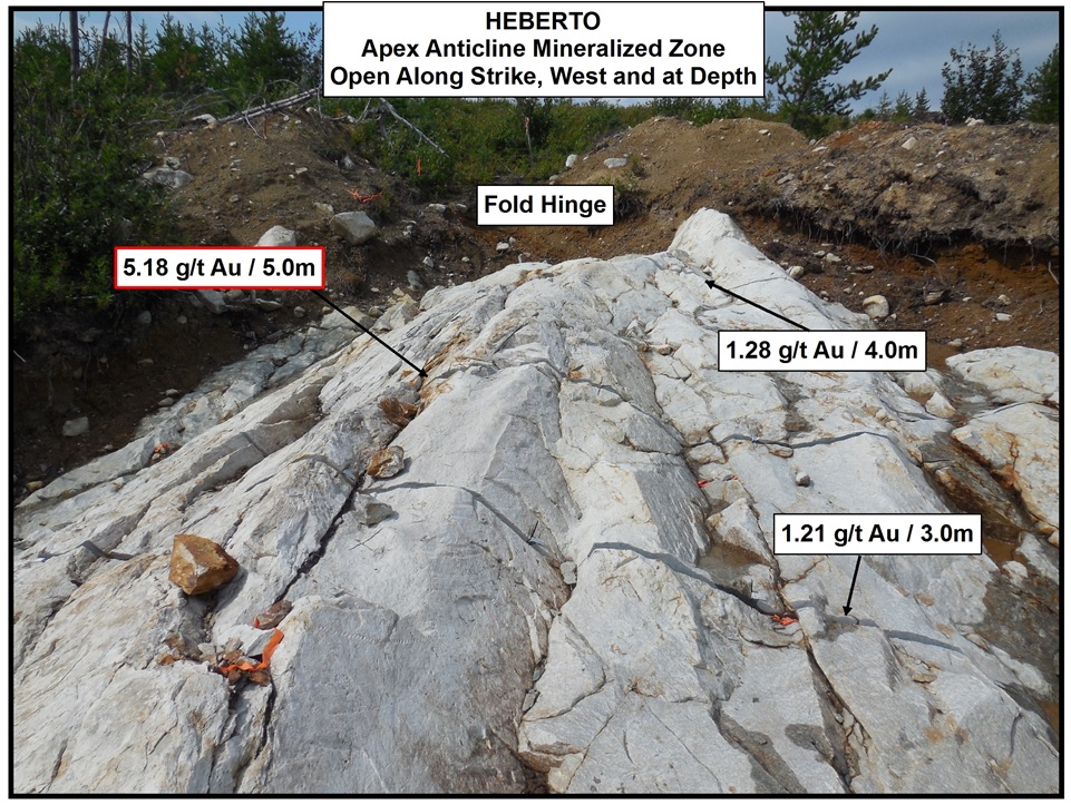
Grooving of this mineralized structure yielded 5.18 g / t gold over 5 m on the available outcrop surface.
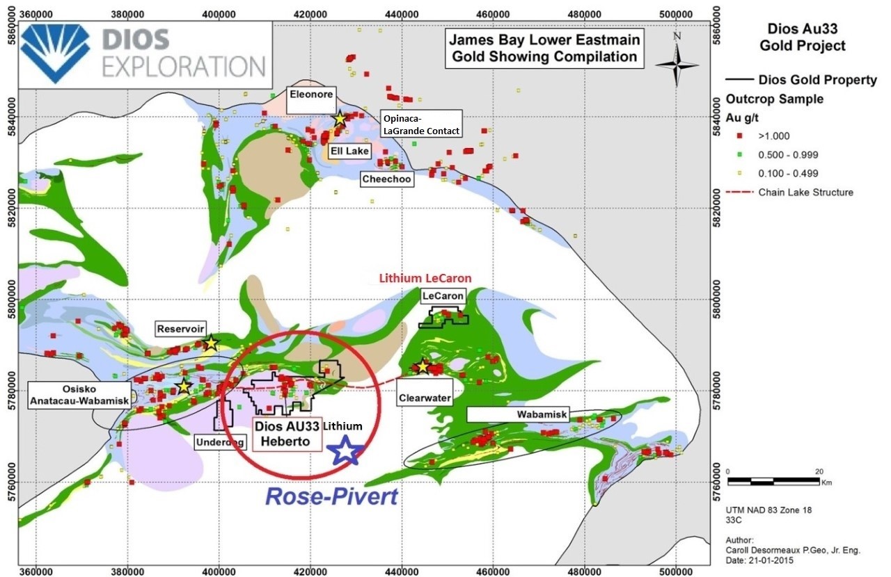
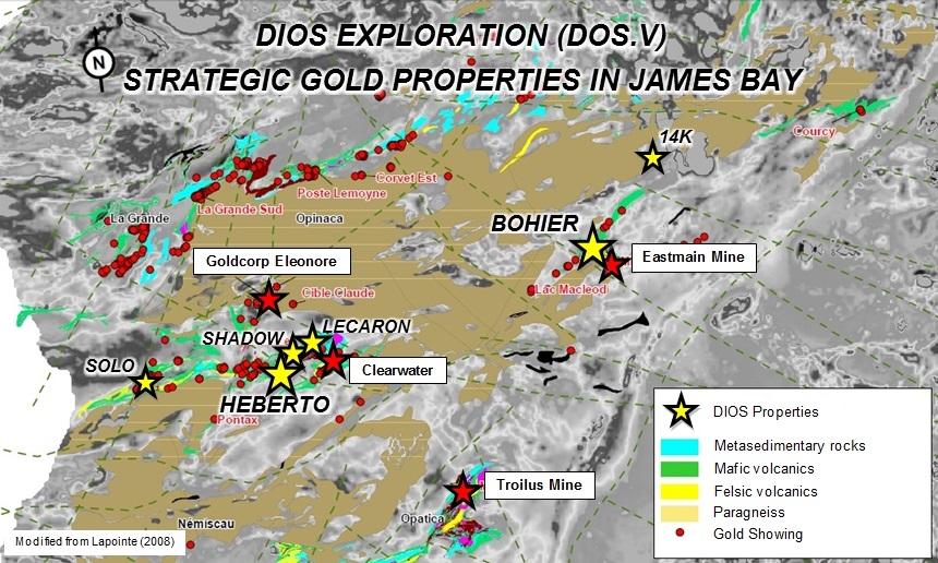
Heberto is located 50 km south of the GOLDCORP Eleonore Gold Mine (24.57 million tonnes proved and probable reserves at 6.3 g / T gold);
and 20 km west of the Clearwater gold deposit (43-101 indicated measured resources of 4.87 Mt at 4.6 g / T gold (721,000 ounces of gold) and inferred resources of 1,122,000 ounces
.


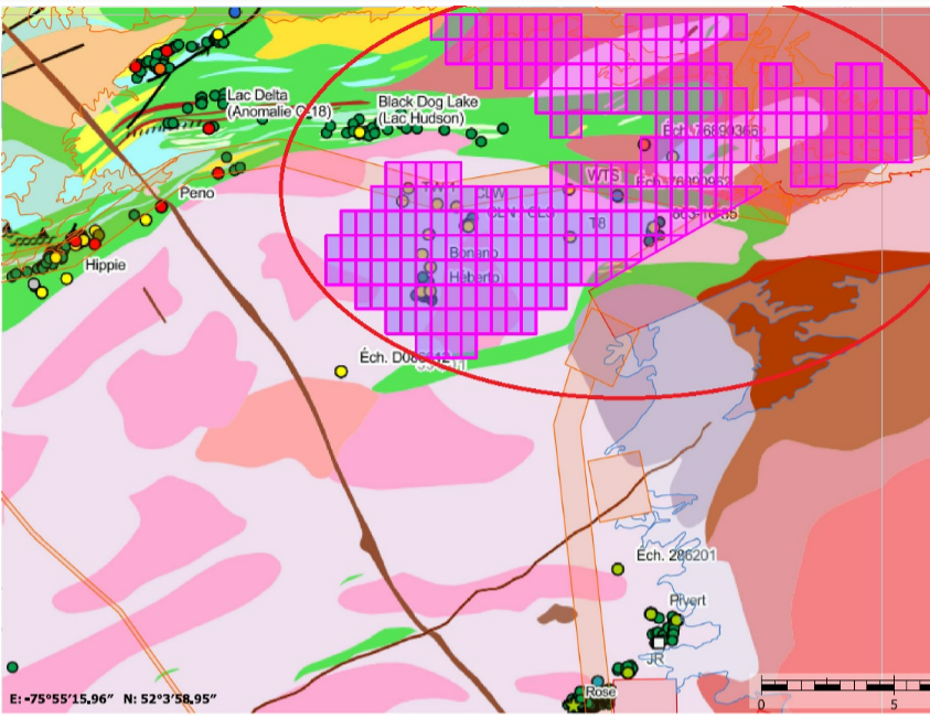
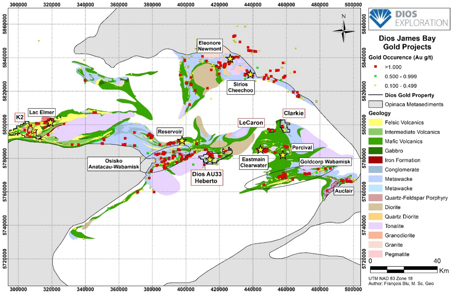
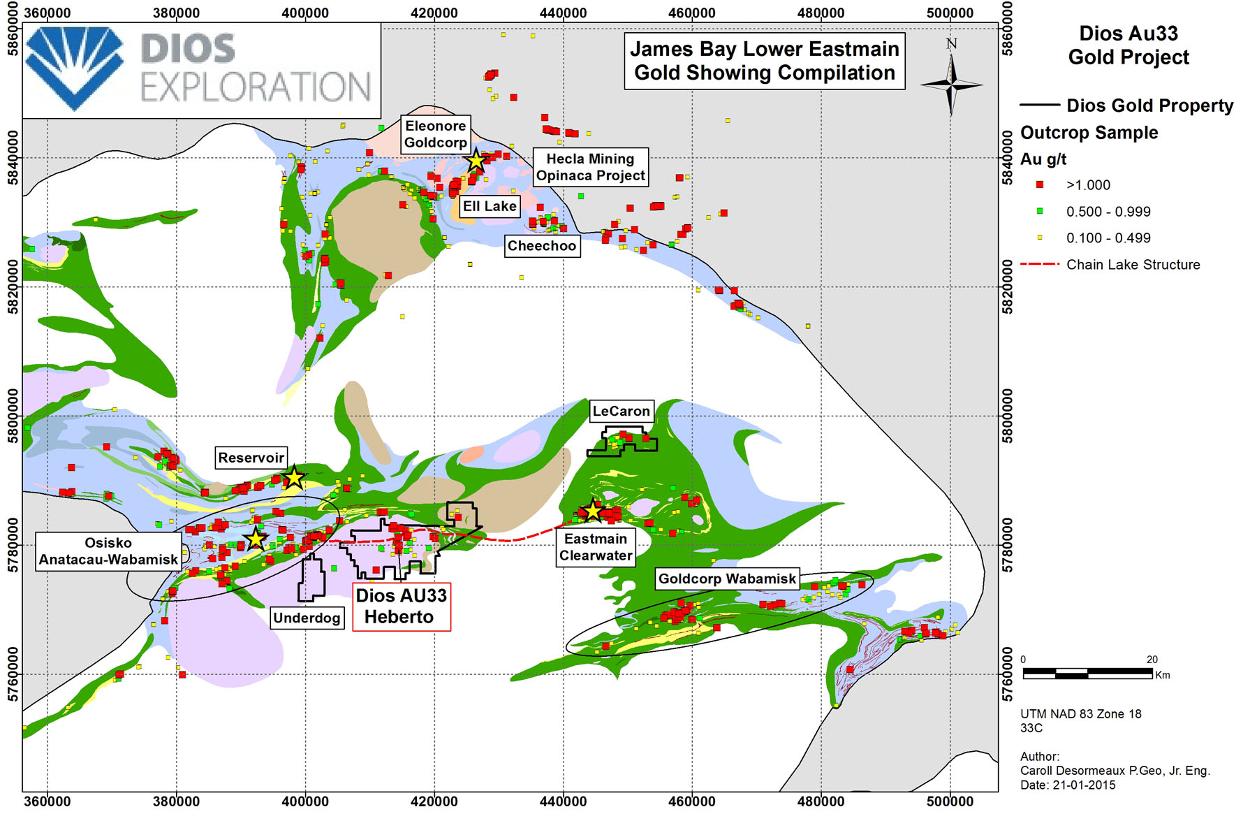
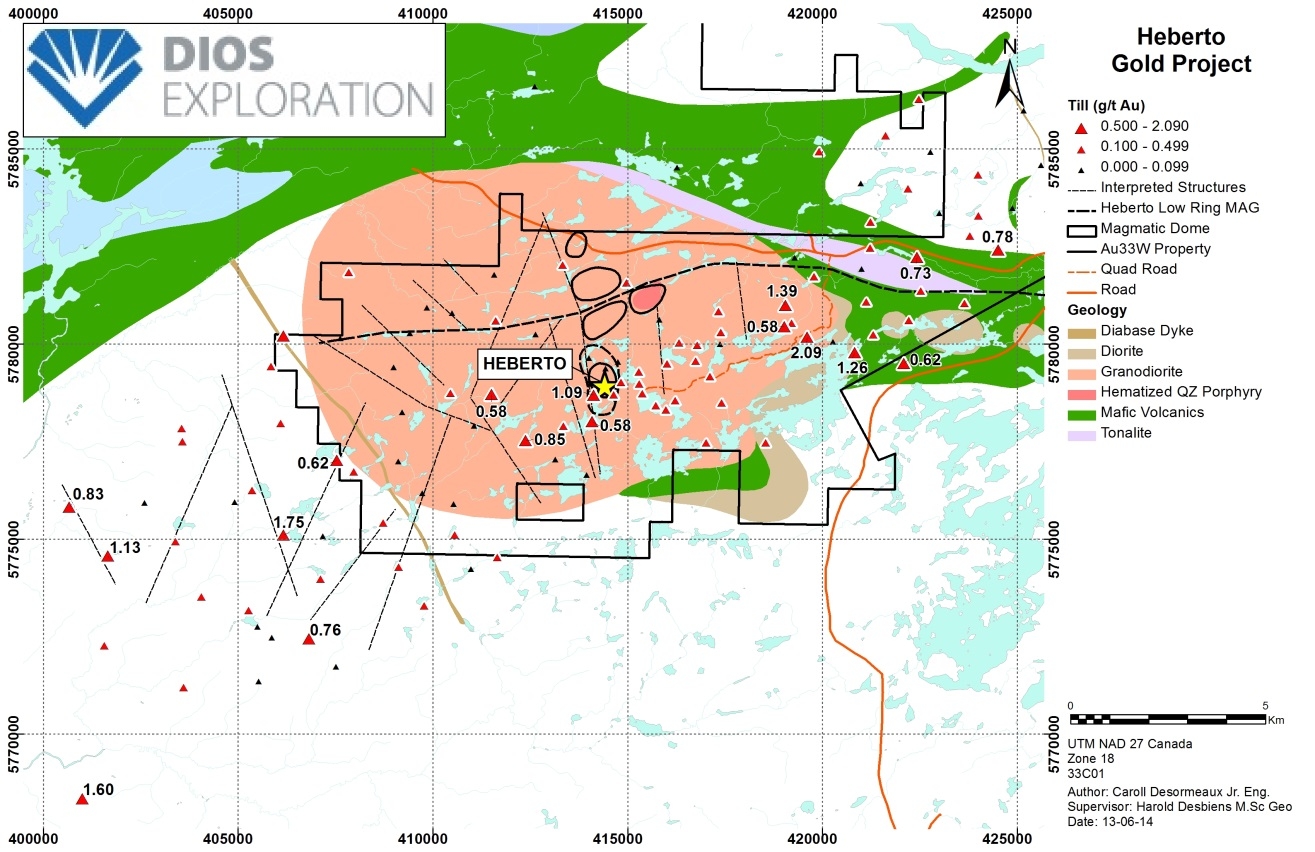
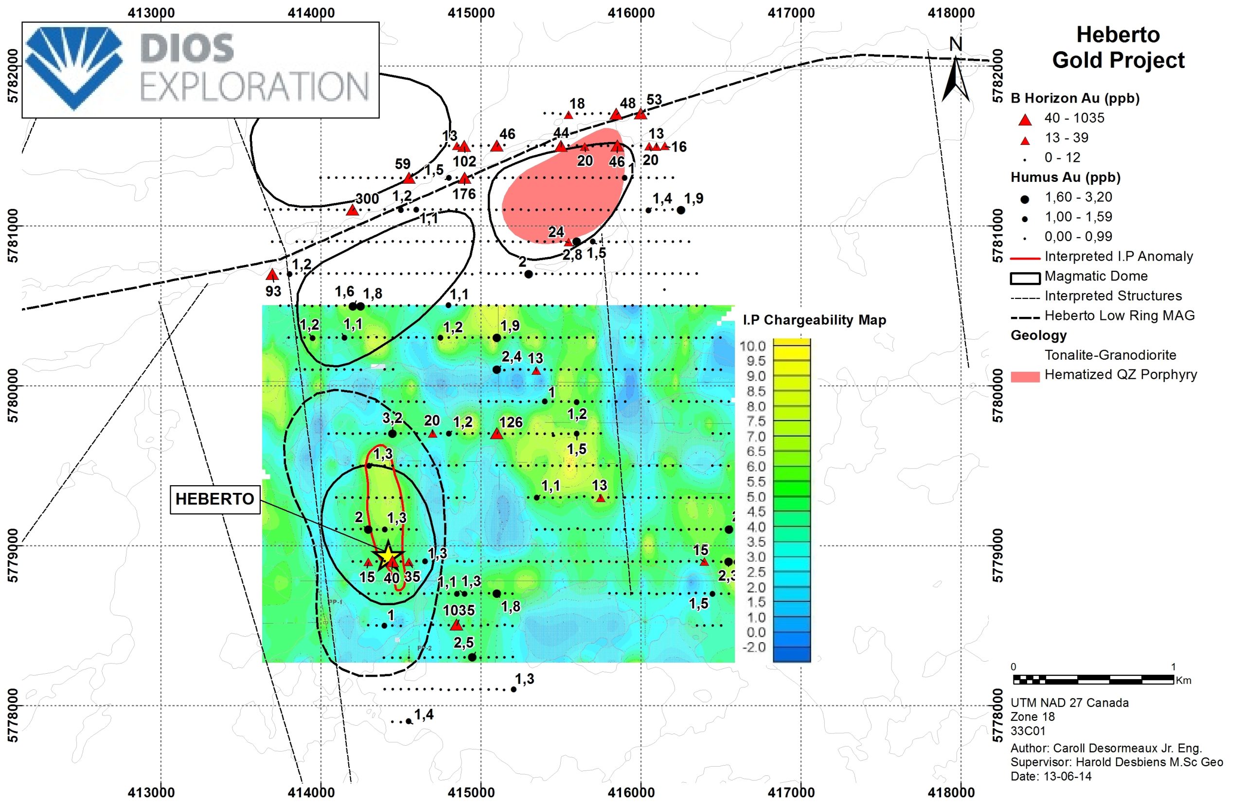
Project AU33WEST, in the Archean Sub-province of La Grande, Superior Province, is centered on small folded sections of the Anatacau-Pivert Formation volcanites surrounding the Archean Mistumis tonalite / diorite-granodiorite pluton. Several structures (magnetic and topographic lineaments) oriented NW, NNO and N-S intersect the local geology.A regional gold structure (Chain Lake Break) intersects from east to west the property. Laterally, it hosts the Clearwater and Mustang-Wabamisk gold systems. Along this large structure developed a complex network of secondary fractures and new gold showings were discovered
The project covers 200 square kilometers intersected by the Eastmain River, near the EM-1 hydroelectric generating station, approximately 350 km northeast of Matagami, James Bay, QC. Access is via the gravel road of Hydro-Québec linking Nemaska / Eastmain-1 / LaSarcelle.

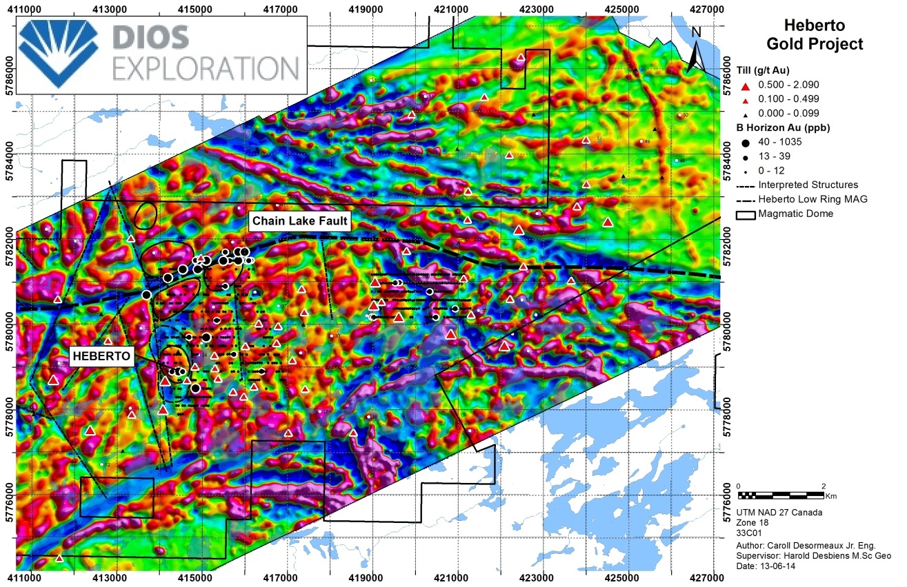
In 2009-2010, the sampling of tills by Dios delineated a well-structured 15km x 3-7km gold-bearing glacial dispersion trail oriented at N240-250 ie. the direction measured in the glacial striations. The compilation of all the data from the DIOS tills and those available on SIGEOM confirms the significant importance of this trail across the Lower Eastmain.
AU33W TILL MAP

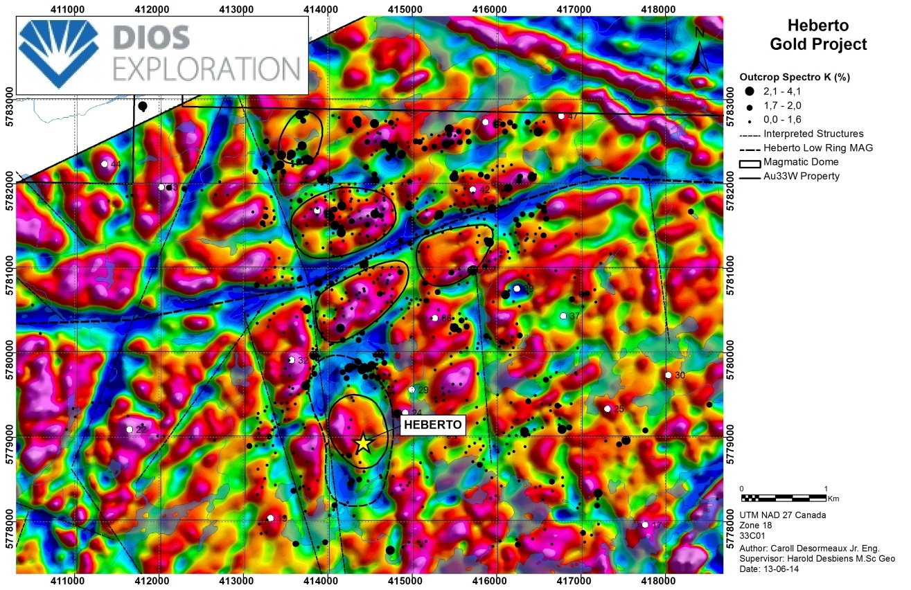
En In 2010, a recognition of 3 days was made at the head of the gold trail. 40 selected samples representative of glacial blocks (basalts and mineralized tonalites), three 40-75 cm (diameter) tonalite blocks with 2-5% disseminated pyrite titrated 0.84 g / t Au, 1.5 g / t Ag, respectively; 2.3 g / t Au, 1.6 g / t Ag; and 2.3 g / t Au, 6.6 g / t Ag. Thin blades on the gold blocks confirmed associated potassium alterations (biotite and microcline).
As of June 2011 (-Nov.2013), Osisko had the option of acquiring a 51% undivided interest in theAU33WEST property and invested $ 1,400,000 in exploration.
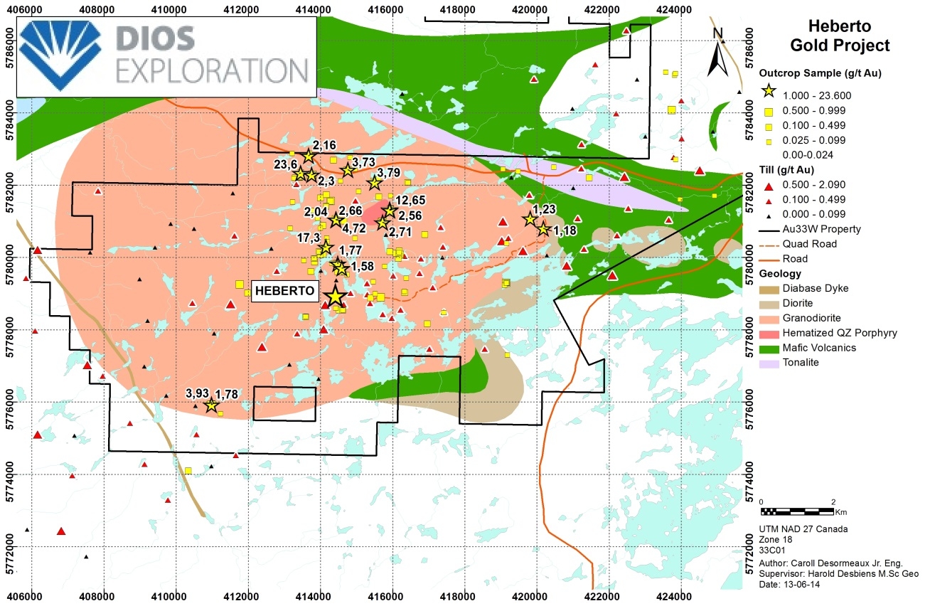
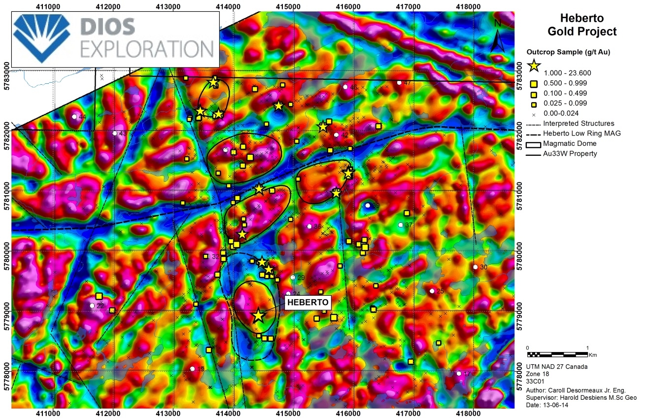
A two-month prospecting program was conducted in 2011, targeting the felsic igneous complex (tonalite-granodiorite), diorites, and volcanic bands upstream of the till and gold block trajectories previously defined by DIOS. The exposed gold mineralization in outcrops is scattered and hosted by fracture plating, including pyrite (1-2%), sometimes accompanied by chalcopyrite and malachite, associated with potassium alteration. Gold values are associated with silver and usually copper grades, suggesting a hydrothermal-magmatic deposit. In July and September 2011, Osisko completed a mapping-prospecting and soil sampling program (2 grids, Horizon B and humus). Dios and Osisko discovered gold showing outcrops (between 0.535 and 3.79 g / t gold) in tonalites.
In the summer of 2012, the work of the summer rock and soil outcrop sampling program revealed at least five new mineralized gold occurrences in a felsic complex (tonalite-granodiorite). Work on the second fall program uncovered outcropping gold showings, including 34 mineralized outcrops clustered in an 18-square-kilometer area. These indices all produced values greater than 100 ppb gold (0.1 g / t Au), seven of which ranged from 1.58 g / t to 23.6 g / t Au. In the fall of 2012, ten trenches were dug to test soil geochemical anomalies or to extend known clues. Some targets could not be investigated properly due to overburden thickness or the rugged nature of the site. The TW7 trench grading 5.0 g / t Au / 5.25m and 1.12g / tAu / 4.5m (HEBERTO index). Several anomalous results of the order of 0.5-1.1 g / t Au over intervals of 0.75 to 2.25m were also obtained on other trenches.

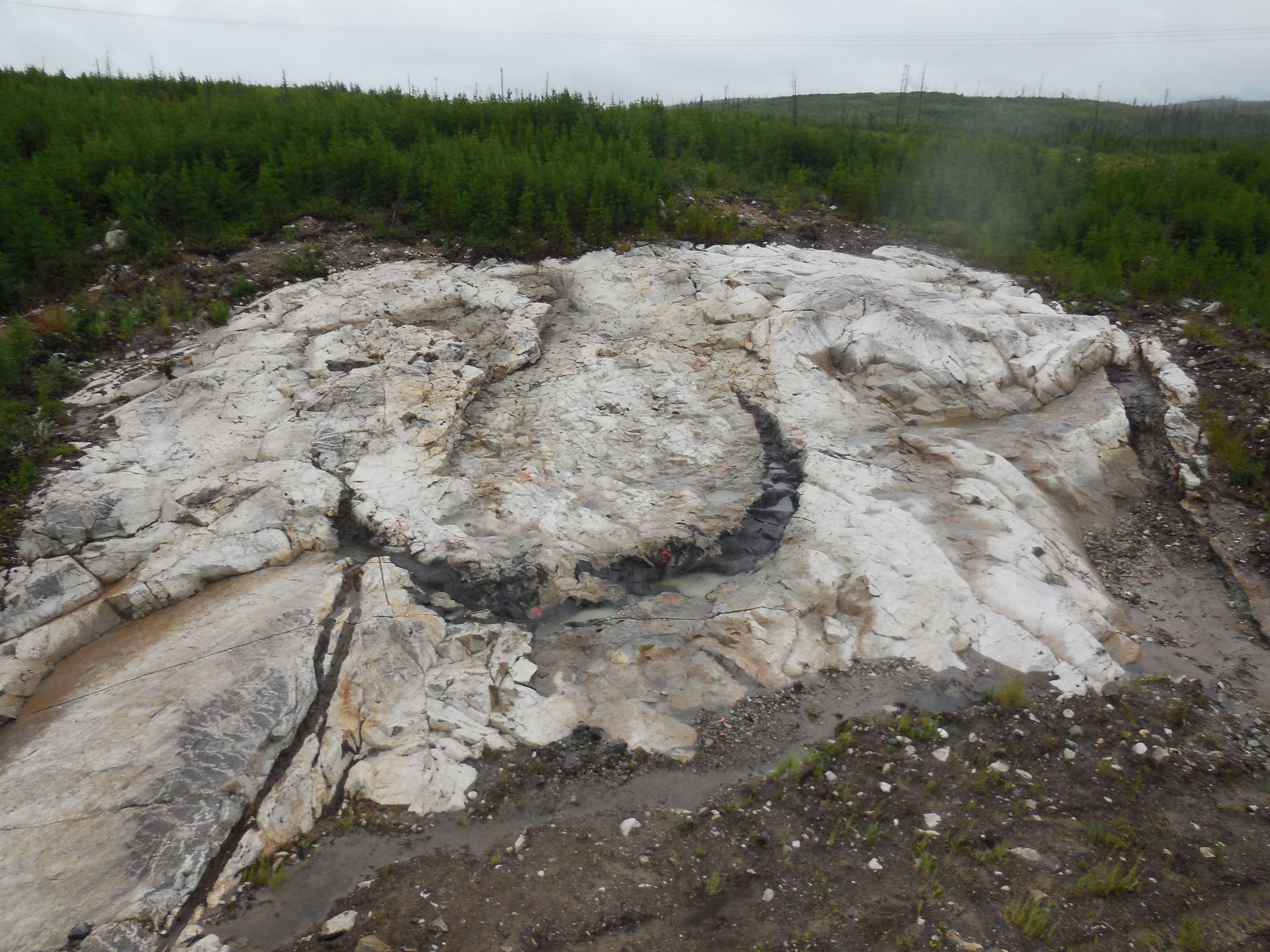
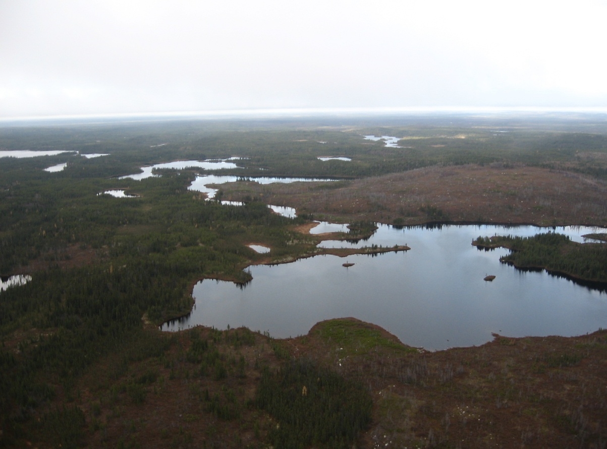
PHOTO HEBERTO INDEX (Looking West)

Osisko completed, 33 kilometers of polarization line provoked on the sector of HEBERTO. In November 2013, Osisko announced the end of its option on AU33W with DIOS due to significant rationalizations of its exploration budget.
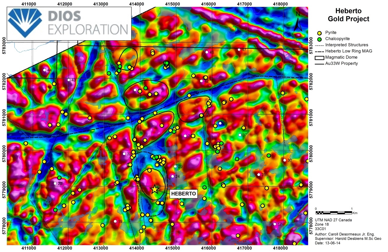
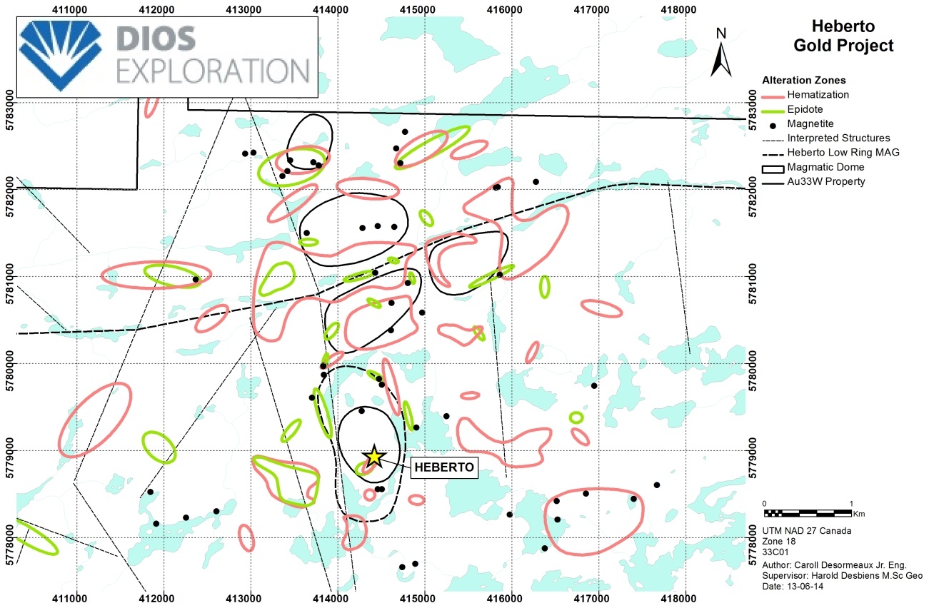
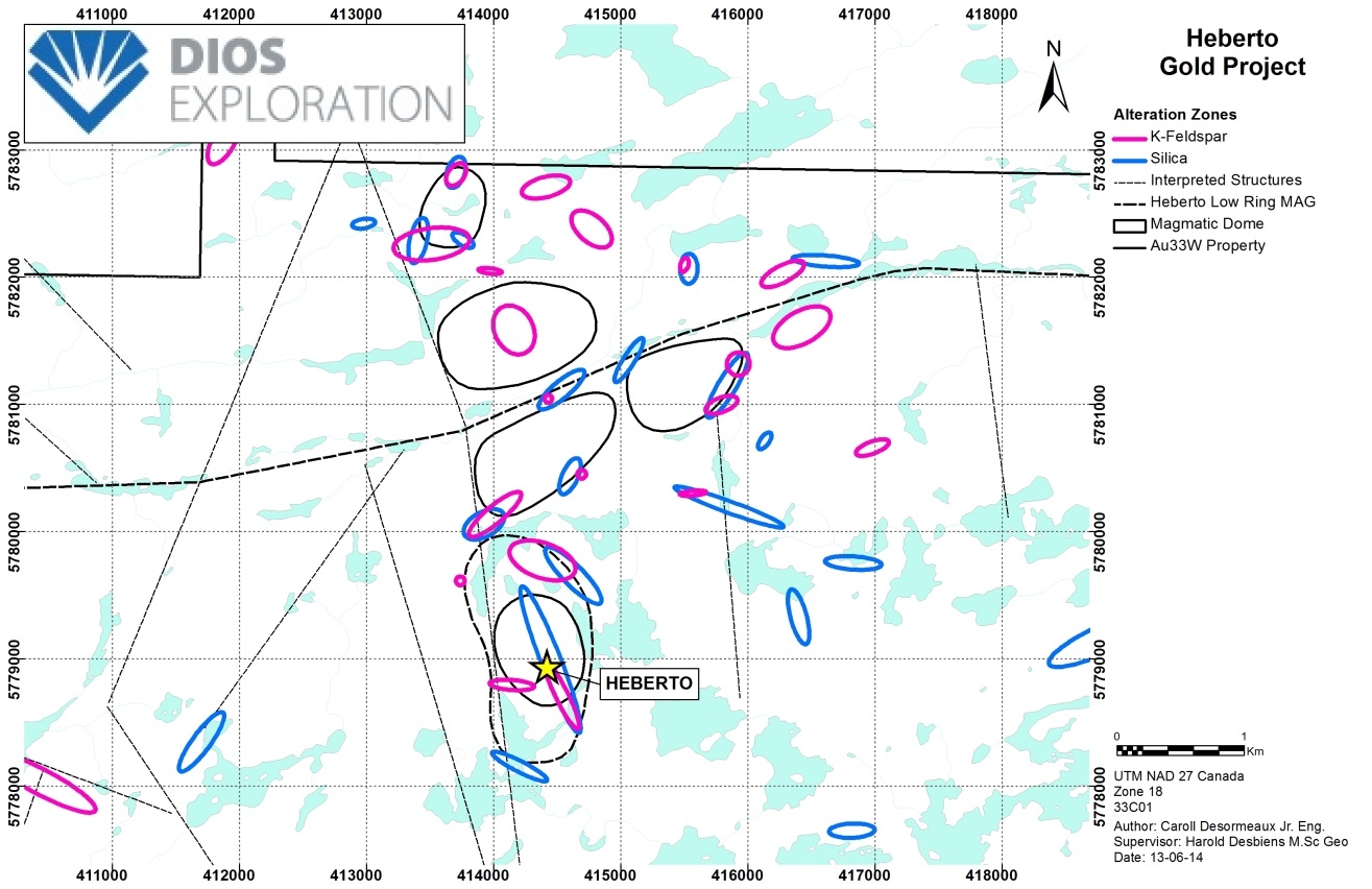
In 2014, DIOS re-examined all geoscience data. Monomineralic maps were used to define the geochemical characteristics of gold fluids carried in large hydrothermal vents AU33WEST. They show good correlations between gold and pyrite, chalcopyrite and / or magnetite-hematite (oxidant system) in the intrusion margins interpreted from magnetic data and geological mapping (lithological and structural).


K MAP VS MAG

In 2014, the detailed mapping of the stripping Heberto defined the APEX ZONE: a north-south mineralized envelope 7 m wide stripped 10 m long grading 1.89 g / t gold and open in extensions north and south, west and deep. The APEX ZONE is contained in an open anticlinal fold with flanks dangling at 40-50 ° on each side, suggesting a potential for mineralization to enlarge near the surface. Grooving of this mineralized structure yielded up to 5.18 g / t gold over 5 m. The average total of one meter (up to 21.4 g / t Au) of 72 Heberto stripping (30m x 10m) is 0.74 g / t gold. The APEX ZONE consists of 1-5% disseminated pyrite with veinlets / quartz stockworks in a foliated quartz diorite altered to biotite and sericite. The APEX ZONE is bordered to the east by lower grade mineralization (50-450 ppb Au) composed of 1% pyrite traces associated with horizontal expansion fractures. In 2014, two selected samples of quartz diorite with quartz veinlets yielded 7.89 and 8.06 g / t gold.
DIOS targets the Heberto and Robino sectors. Concentric structures intersected with brittle mineralized gold structures, combined with the recent discovery of a magmatic-hydrothermal breccia, suggest the presence of buried magmatic domes. In 2014, detailed mapping confirmed the presence of a diorite-tonalite complex in which felsic intrusions were injected with associated dioritic masses and breccias. The north-south brittle structures appear to have controlled the emplacement of breccias, alterations, and gold mineralization. In addition, the large regional gold anomaly in the till and the highly anomalous gold background of the fractured intrusion suggest a large buried mineralized system. The geological context of the Heberto area suggests an oxidized intrusion-associated (IRG) gold system accessible by road to James Bay in Quebec.
